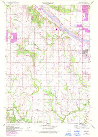
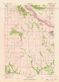
1957 Map of Bixby
USGS Topo · Published 1993About this map
Arkansas River floods and the regional petroleum economy shape this landscape south of Tulsa, where extensive oil wells and oil tanks are scattered across the terrain. The growth of Bixby is evident along Memorial Drive, protected from the river's northern bank by a prominent levee. Further west, Glenpool appears as a concentrated settlement amidst the oil fields, while rural life is anchored by community landmarks such as Shellenbarger Ch, Riverview Ch, and the Bixby Cem. In the southern portion of the quadrangle, the Liberty Corporate Boundary defines a more sparsely populated area near Liberty Sch and Duck Creek Ch. The inclusion of an Industrial Waste Disposal site near the river and numerous radio towers reflects the mid-century transition from a purely agricultural and oil-driven landscape toward more complex infrastructure.
Find a feature on this map
28 named features on this map. Tap any name to fly to it.
Don’t see what you’re looking for? This feature index may not catch every label — zoom into the map to look around manually.
Map Details
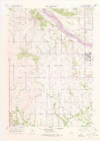
Editions of this 1957 Bixby Map
6 editions found
Other maps of this area

1896 · Okmulgee
USGS Topo · 1:125,000

1900 · Okmulgee
USGS Topo · 1:125,000

1901 · Claremore
USGS Topo · 1:125,000

1901 · Nuyaka
USGS Topo · 1:125,000

1912 · Hominy
USGS Topo · 1:125,000

1914 · Kiefer
USGS Topo · 1:62,500

1914 · Claremore
USGS Topo · 1:125,000

1915 · Hominy
USGS Topo · 1:125,000

1916 · Kiefer
USGS Topo · 1:62,500

1916 · Claremore
USGS Topo · 1:125,000