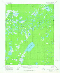
1956 Map of Black River C-6
USGS Topo · Published 1965About this map
Chalkyitsik sits at the heart of this landscape, positioned along a sharp bend of the meandering Black River in the Yukon-Koyukuk region. This 1950s era survey captures the settlement's early aviation and transport links, specifically noting the Landing Strip and Chalkyitsik Slough that supported the remote community. The terrain is defined by a complex network of oxbow lakes and wetlands, where the river's path is shadowed by features like Fishhook Creek and the Grass River to the south.
Find a feature on this map
17 named features on this map. Tap any name to fly to it.
Don’t see what you’re looking for? This feature index may not catch every label — zoom into the map to look around manually.
Map Details
Editions of this 1956 Black River C-6 Map
3 editions found
Other maps of this area

1951 · Fort Yukon
USGS Topo · 1:250,000

1951 · Black River
USGS Topo · 1:250,000

1956 · Fort Yukon C-1
USGS Topo · 1:63,360

1956 · Black River B-6
USGS Topo · 1:63,360

1956 · Black River D-6
USGS Topo · 1:63,360

1956 · Black River B-5
USGS Topo · 1:63,360

1956 · Black River D-5
USGS Topo · 1:63,360

1956 · Black River C-6
USGS Topo · 1:63,360

1956 · Fort Yukon B-1
USGS Topo · 1:63,360

1956 · Black River C-5
USGS Topo · 1:63,360