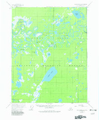
1956 Map of Black River C-6
USGS Topo · Published 1982About this map
Chalkyitsik sits at a strategic bend along the Chalkyitsik Slough, serving as a central point of habitation within the sprawling Yukon Flats in the mid-1950s. This interior landscape is defined by the highly sinuous path of the Black River and the Grass River, which wind through a mosaic of wetlands and named water bodies such as Ohtig Lake and Chahalie Lake. The presence of a Landing Strip and Cem at the settlement, along with a Tractor Trail cutting through the northern reaches, highlights the essential, limited infrastructure required for life and travel in this subarctic environment. To the east, the terrain shifts slightly at Red Bluff, providing a rare named landmark amidst the dense network of oxbows and timber-surrounded lakes like Big Timber Lake and Small Timber Lake.
Find a feature on this map
27 named features on this map. Tap any name to fly to it.
Don’t see what you’re looking for? This feature index may not catch every label — zoom into the map to look around manually.
Map Details
Editions of this 1956 Black River C-6 Map
3 editions found
Other maps of this area

1951 · Fort Yukon
USGS Topo · 1:250,000

1951 · Black River
USGS Topo · 1:250,000

1956 · Fort Yukon C-1
USGS Topo · 1:63,360

1956 · Black River B-6
USGS Topo · 1:63,360

1956 · Black River D-6
USGS Topo · 1:63,360

1956 · Black River B-5
USGS Topo · 1:63,360

1956 · Black River D-5
USGS Topo · 1:63,360

1956 · Black River C-6
USGS Topo · 1:63,360

1956 · Fort Yukon B-1
USGS Topo · 1:63,360

1956 · Black River C-5
USGS Topo · 1:63,360