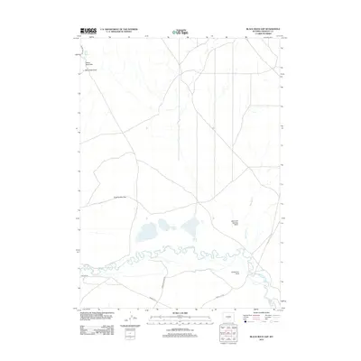
2012 Map of Black Rock Gap
USGS Topo · Published 2012About this map
The Oregon Trl winds through this high-desert portion of Wyoming, tracing a path south of the meandering Sweetwater River. This 2012 survey illustrates the enduring nature of the historical trail corridor as it passes near the Soda Lakes and navigates through topographical markers like Quaking Asp Gap. The landscape is defined by its drainages and geological features, including the notable Jamerman Rock and the drainage of Diamond Springs Draw. Roads such as Green Mountain Rd and Agate Flat Rd intersect the terrain, providing modern access to remote landmarks like Black Rock Gap and Black Rock Spring. The hydrology of the area is further marked by the presence of Sage Hen Cr, which feeds toward the main river valley.
Find a feature on this map
13 named features on this map. Tap any name to fly to it.
Don’t see what you’re looking for? This feature index may not catch every label — zoom into the map to look around manually.
Map Details
Editions of this 2012 Black Rock Gap Map
This is the sole edition of this map. No revisions or reprints were ever made.
Other maps of this area

1951 · Crooks Creek NE
USGS Topo · 1:24,000

1951 · Stampede Meadow
USGS Topo · 1:24,000

1951 · Black Rock Gap
USGS Topo · 1:24,000

1951 · Split Rock
USGS Topo · 1:24,000

1951 · Split Rock NW
USGS Topo · 1:24,000

1951 · Lankin Dome
USGS Topo · 1:24,000

1952 · Muskrat Basin
USGS Topo · 1:24,000

1952 · Coyote Springs
USGS Topo · 1:24,000

1952 · Mc Intosh Meadows
USGS Topo · 1:24,000

1955 · Casper
USGS Topo · 1:250,000