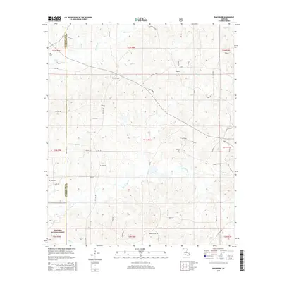
2015 Map of Blackburn
USGS Topo · Published 2015About this map
Blackburn and Ruple anchor this rural landscape in the 2010s, situated along the border of Webster and Claiborne Parishes. The area is defined by its numerous family and community cemeteries, including King Cem, Cold Spring Cem, and Wheaton Cem, which offer significant value for genealogical research. The southern portion of the map transitions into the Kisatchie National Forest, showing the intersection of managed timberlands and private holdings. A complex network of drainage basins is evident, with Flat Lick Bayou and Black Bayou carving through the terrain. The presence of Homer Oilfield Rd indicates the regional importance of the energy industry, while the density of parish roads and small spurs like LA-534 Spur reveals a settled, working landscape of small family plots and timber tracks that have persisted through the generations.
Find a feature on this map
66 named features on this map. Tap any name to fly to it.
Don’t see what you’re looking for? This feature index may not catch every label — zoom into the map to look around manually.
Map Details
Editions of this 2015 Blackburn Map
This is the sole edition of this map. No revisions or reprints were ever made.
Other maps of this area

1922 · Sarepta
USGS Topo · 1:62,500

1924 · Sarepta
USGS Topo · 1:62,500

1947 · Minden
USGS Topo · 1:62,500

1949 · Minden
USGS Topo · 1:62,500

1949 · Gibsland
USGS Topo · 1:62,500

1950 · Gibsland
USGS Topo · 1:62,500

1952 · Homer
USGS Topo · 1:62,500

1955 · Shreveport
USGS Topo · 1:250,000

1956 · Shreveport
USGS Topo · 1:250,000

1956 · Sarepta
USGS Topo · 1:62,500