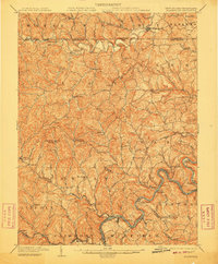
1904 Map of Blacksville
USGS Topo · Published 1910About this map
Dunkard Creek meanders along the border of West Virginia and Pennsylvania, anchoring a landscape defined by coal-country topography and the industrial corridor of the Monongahela River. This 1904 survey reveals a dense network of early 20th-century settlements, many identified by dual names or post office designations such as Fairview Amos PO and McCurdyville Center PO. The rugged terrain of the Dunkard and Battelle districts is etched with numerous runs and drains, while larger infrastructure projects like the Baltimore and Ohio RR and the Fairmont and Morgantown Turnpike facilitate movement through the river valleys. Along the river, a series of navigational controls including Lock No. 12 and Lock No. 13 mark the era's reliance on waterborne commerce, connecting towns like Lowsville and Little Falls to the broader regional economy.
Find a feature on this map
112 named features on this map. Tap any name to fly to it.
Don’t see what you’re looking for? This feature index may not catch every label — zoom into the map to look around manually.
Map Details
Editions of this 1904 Blacksville Map
3 editions found
Other maps of this area

1886 · St. George
USGS Topo · 1:125,000

1891 · St. George
USGS Topo · 1:125,000

1900 · Masontown
USGS Topo · 1:62,500

1901 · Waynesburg
USGS Topo · 1:62,500

1902 · Clarksburg
USGS Topo · 1:62,500

1902 · Fairmont
USGS Topo · 1:62,500

1902 · Morgantown
USGS Topo · 1:62,500

1903 · Masontown
USGS Topo · 1:62,500

1904 · Blacksville
USGS Topo · 1:62,500

1904 · Waynesburg
USGS Topo · 1:62,500