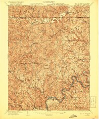
1904 Map of Blacksville
USGS Topo · Published 1919About this map
Dunkard Creek and its many tributary runs carve through the borderlands between West Virginia and Pennsylvania, defining a landscape of small agricultural and mining settlements at the dawn of the twentieth century. The community of Blacksville sits just south of the Pennsylvania West Virginia boundary line, serving as a hub for the surrounding hollows. Movement through the region was anchored by the Morgantown and Fairmont Turnpike, while the Baltimore and Ohio RR provided critical industrial connections for towns like Rivesville and Stafford. Along the river, a system of navigation is evident through Lock No. 14 and Lock No. 12, which facilitated the movement of goods. Genealogists will find interest in localized post offices and settlements such as Fairview Amos PO, Center PO McCurdyville, and Beechwood PO, which reflect the early distribution of mail and community life in Monongalia and Marion counties.
Find a feature on this map
104 named features on this map. Tap any name to fly to it.
Don’t see what you’re looking for? This feature index may not catch every label — zoom into the map to look around manually.
Map Details
Editions of this 1904 Blacksville Map
3 editions found
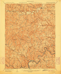
Other maps of this area

1886 · St. George
USGS Topo · 1:125,000

1891 · St. George
USGS Topo · 1:125,000

1900 · Masontown
USGS Topo · 1:62,500

1901 · Waynesburg
USGS Topo · 1:62,500

1902 · Clarksburg
USGS Topo · 1:62,500

1902 · Fairmont
USGS Topo · 1:62,500

1902 · Morgantown
USGS Topo · 1:62,500

1903 · Masontown
USGS Topo · 1:62,500

1904 · Blacksville
USGS Topo · 1:62,500

1904 · Waynesburg
USGS Topo · 1:62,500