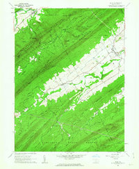
1960 Map of Blain
USGS Topo · Published 1963About this map
Tuscarora Mountain and Rising Mountain define this section of the Ridge-and-Valley Appalachians, creating a landscape of narrow agricultural strips separated by heavily forested ridges. The settlement of Blain serves as a local hub near Sherman Creek, while smaller hamlets like New Germantown and Center Square follow the valley floors. These communities are anchored by local landmarks such as Three Springs Ch and Fairview Ch, providing essential reference points for genealogists. Much of the high ground is preserved within the Tuscarora State Forest, where a Lookout Tower stands on Big Knob at the head of Kansas Valley Run. The presence of several pipelines cutting across Horse Valley and the surrounding ridges reflects the post-war expansion of industrial infrastructure through this rural Perry County terrain.
Find a feature on this map
44 named features on this map. Tap any name to fly to it.
Don’t see what you’re looking for? This feature index may not catch every label — zoom into the map to look around manually.
Map Details
Editions of this 1960 Blain Map
4 editions found
Other maps of this area

1919 · Newville
USGS Topo · 1:62,500

1919 · Mattawana
USGS Topo · 1:62,500

1923 · Shippensburg
USGS Topo · 1:62,500

1930 · Loysville
USGS Topo · 1:62,500

1933 · Loysville
USGS Topo · 1:62,500

1936 · East Waterford
USGS Topo · 1:48,000

1941 · East Waterford
USGS Topo · 1:62,500

1943 · Shippensburg
USGS Topo · 1:62,500

1945 · Newville
USGS Topo · 1:62,500

1945 · Shippensburg
USGS Topo · 1:62,500