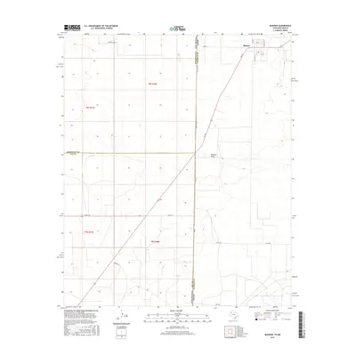
2016 Map of Bledsoe
USGS Topo · Published 2016About this map
The settlement of Bledsoe sits at the high plains crossroads of FM 769 and FM 2182, just east of the Texas and New Mexico border. This 2016 survey documents a landscape defined by the intersection of ranching interests and the geometrical precision of the Public Land Survey System. The state line is physically represented by State Line Rd, dividing Roosevelt County and Lea County in New Mexico from Cochran County in Texas. To the south, the natural drainage of Sulphur Draw cuts across the otherwise orderly grid of section lines and ranch roads like Gandy Rd. Named holdings such as Walking Cane Ranch and Two B Ranch NW indicate the enduring presence of large-scale livestock operations in this corner of the Llano Estacado. The presence of a local Po in the center of town marks the community hub for this remote borderland region.
Find a feature on this map
20 named features on this map. Tap any name to fly to it.
Don’t see what you’re looking for? This feature index may not catch every label — zoom into the map to look around manually.
Map Details
Editions of this 2016 Bledsoe Map
This is the sole edition of this map. No revisions or reprints were ever made.
Other maps of this area

1954 · Brownfield
USGS Topo · 1:250,000

1958 · Brownfield
USGS Topo · 1:250,000

1962 · Brownfield
USGS Topo · 1:250,000

1970 · Bronco NE
USGS Topo · 1:24,000

1970 · Walking Cane Ranch
USGS Topo · 1:24,000

1970 · Bledsoe
USGS Topo · 1:24,000

1970 · Morton SW
USGS Topo · 1:24,000

1970 · Morton NW
USGS Topo · 1:24,000

1970 · Bledsoe NE
USGS Topo · 1:24,000
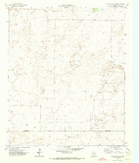
1971 · Two B Ranch NW
USGS Topo · 1:24,000