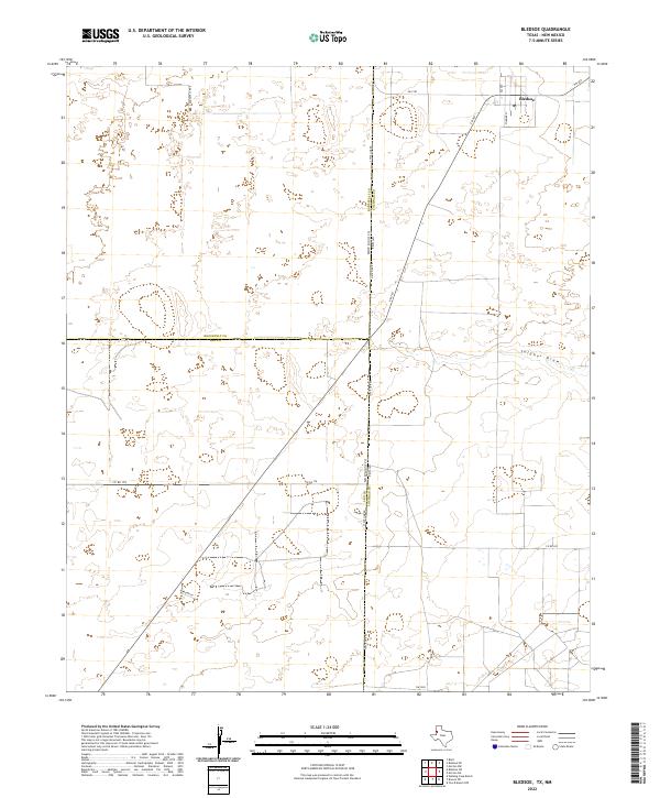
2022 Map of Bledsoe
USGS Topo · Published 2022About this map
Bledsoe sits at the northern edge of this high plains landscape, positioned just east of the state boundary where the Llano Estacado transitions across the New Mexico and Texas border. This modern 2022 survey captures the grid of the small community, including the Po and Filmore St, serving as a vital point of reference for researchers tracing the recent history of Cochran County. The surrounding terrain is defined by the shallow depression of Sulphur Draw, which wanders through the eastern section of the map, and the intersection of State Line Rd marking the precise divide between the two states.
Find a feature on this map
22 named features on this map. Tap any name to fly to it.
Don’t see what you’re looking for? This feature index may not catch every label — zoom into the map to look around manually.
Map Details
Editions of this 2022 Bledsoe Map
This is the sole edition of this map. No revisions or reprints were ever made.
Other maps of this area

1954 · Brownfield
USGS Topo · 1:250,000

1958 · Brownfield
USGS Topo · 1:250,000

1962 · Brownfield
USGS Topo · 1:250,000

1970 · Bronco NE
USGS Topo · 1:24,000

1970 · Walking Cane Ranch
USGS Topo · 1:24,000

1970 · Bledsoe
USGS Topo · 1:24,000

1970 · Morton SW
USGS Topo · 1:24,000

1970 · Morton NW
USGS Topo · 1:24,000

1970 · Bledsoe NE
USGS Topo · 1:24,000
1971 · Two B Ranch NW
USGS Topo · 1:24,000