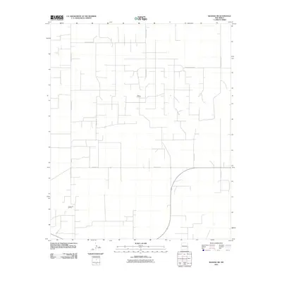
2010 Map of Bledsoe SW
USGS Topo · Published 2010About this map
The Allison Oil Field and Crossroads Oil Field define the industrial footprint of this high plains region in Lea County. In 2010, the landscape is marked by a precise, geometric network of local roads that serve both agricultural and petroleum extraction purposes. Transport across the terrain relies on a grid of numbered and lettered routes, such as S Roosevelt Road 44 and S Roosevelt Road L, which facilitate movement between scattered oil infrastructure and rural tracts. The presence of Bun Rd and various county arteries like County Rd-173 reflects the organized development of this corner of New Mexico. This map reveals the intersection of public land management and energy production in a landscape designed for utility and access.
Find a feature on this map
11 named features on this map. Tap any name to fly to it.
Don’t see what you’re looking for? This feature index may not catch every label — zoom into the map to look around manually.
Map Details
Editions of this 2010 Bledsoe SW Map
This is the sole edition of this map. No revisions or reprints were ever made.
Other maps of this area

1954 · Brownfield
USGS Topo · 1:250,000

1958 · Brownfield
USGS Topo · 1:250,000

1962 · Brownfield
USGS Topo · 1:250,000

1970 · Bronco NE
USGS Topo · 1:24,000

1970 · Walking Cane Ranch
USGS Topo · 1:24,000

1970 · Ranger Lake
USGS Topo · 1:24,000

1970 · Bledsoe
USGS Topo · 1:24,000

1970 · Bledsoe NE
USGS Topo · 1:24,000

1972 · Bluit
USGS Topo · 1:24,000
1972 · Bledsoe SW
USGS Topo · 1:24,000