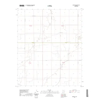
2023 Map of Bledsoe SW
USGS Topo · Published 2023About this map
The High Plains of eastern New Mexico intersect at the Roosevelt Co Lea Co line, defining a landscape of precise township grids and isolated rural access. This 2023 survey illustrates the modern layout of these high-desert lands, where the Public Land Survey System (PLSS) sections like t8s r36e and t9s r37e dictate the movement of local traffic. The road network is a mixture of state and local designations, including S Roosevelt Road 44 and Baldridge Rd, which serve the agricultural and ranching interests that have historically defined this border region.
Find a feature on this map
16 named features on this map. Tap any name to fly to it.
Don’t see what you’re looking for? This feature index may not catch every label — zoom into the map to look around manually.
Map Details
Editions of this 2023 Bledsoe SW Map
This is the sole edition of this map. No revisions or reprints were ever made.
Other maps of this area

1954 · Brownfield
USGS Topo · 1:250,000

1958 · Brownfield
USGS Topo · 1:250,000

1962 · Brownfield
USGS Topo · 1:250,000

1970 · Bronco NE
USGS Topo · 1:24,000

1970 · Walking Cane Ranch
USGS Topo · 1:24,000

1970 · Ranger Lake
USGS Topo · 1:24,000

1970 · Bledsoe
USGS Topo · 1:24,000

1970 · Bledsoe NE
USGS Topo · 1:24,000

1972 · Bluit
USGS Topo · 1:24,000
1972 · Bledsoe SW
USGS Topo · 1:24,000