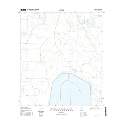
2016 Map of Blessing SE
USGS Topo · Published 2016About this map
The Colorado River dominates the eastern edge of this coastal prairie landscape, winding through a network of riparian channels including the W Br Colorado River and Lake Le Tulle. This 2016 survey illustrates the heavy industrial and agricultural management of Matagorda County's water resources, most notably through the massive Cooling Water Reservoir that occupies a significant portion of the southern terrain. This artificial water body is surrounded by a grid of rural roads and sloughs, such as Johnsons-Timber Slough and Willow Dam Slough, which drain the low-lying acreage between the river and local ranch lands. Smaller natural features like Kelly Lake and the marshy grounds of Wild Cow Island provide a stark contrast to the engineered geometry of the reservoir, revealing the complex drainage patterns of the Texas Gulf Coast as they appeared in the mid-2010s.
Find a feature on this map
33 named features on this map. Tap any name to fly to it.
Don’t see what you’re looking for? This feature index may not catch every label — zoom into the map to look around manually.
Map Details
Editions of this 2016 Blessing SE Map
This is the sole edition of this map. No revisions or reprints were ever made.
Other maps of this area

1951 · Bay City
USGS Topo · 1:250,000

1952 · Matagorda
USGS Topo · 1:24,000

1952 · Blessing SE
USGS Topo · 1:24,000

1952 · Palacios
USGS Topo · 1:24,000

1952 · Blessing
USGS Topo · 1:24,000

1952 · Bay City
USGS Topo · 1:24,000

1952 · Markham
USGS Topo · 1:24,000

1952 · Midfield
USGS Topo · 1:24,000

1952 · Palacios NE
USGS Topo · 1:24,000

1952 · Wadsworth
USGS Topo · 1:24,000