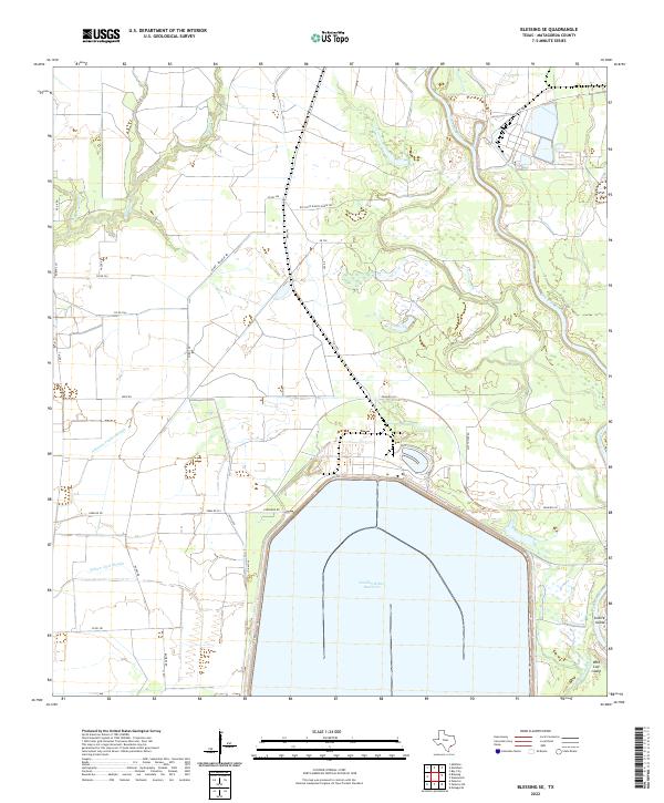
2022 Map of Blessing SE
USGS Topo · Published 2022About this map
The Colorado River dominates the eastern edge of this coastal Matagorda County landscape, where the main channel and the W Br Colorado River carve through the lowlands around Selkirk Island and Wild Cow Island. Central to the modern character of this area is the massive Cooling Water Reservoir, a prominent industrial feature serviced by a network of private roads including W STP Rd and STP Rd. The surrounding terrain is defined by its complex drainage patterns, with numerous sloughs such as Johnsons Timber Slough, Compress Slough, and Willow Dam Slough winding through the fields. Local family and ranching heritage is visible in the naming of rural routes like Bieri Rd, Vacek Rd, and the Rio Veijo Ranch House Rd, indicating the long-standing agricultural use of this river-delta region.
Find a feature on this map
31 named features on this map. Tap any name to fly to it.
Don’t see what you’re looking for? This feature index may not catch every label — zoom into the map to look around manually.
Map Details
Editions of this 2022 Blessing SE Map
This is the sole edition of this map. No revisions or reprints were ever made.
Other maps of this area

1951 · Bay City
USGS Topo · 1:250,000

1952 · Matagorda
USGS Topo · 1:24,000

1952 · Blessing SE
USGS Topo · 1:24,000

1952 · Palacios
USGS Topo · 1:24,000

1952 · Blessing
USGS Topo · 1:24,000

1952 · Bay City
USGS Topo · 1:24,000

1952 · Markham
USGS Topo · 1:24,000

1952 · Midfield
USGS Topo · 1:24,000

1952 · Palacios NE
USGS Topo · 1:24,000

1952 · Wadsworth
USGS Topo · 1:24,000