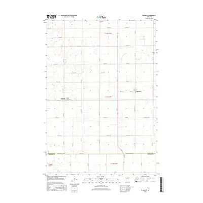
2016 Map of Blomkest
USGS Topo · Published 2016About this map
Agricultural patterns and a grid-like road network define this portion of the Minnesota prairie, where the towns of Roseland and Blomkest serve as local hubs. The landscape is marked by the systematic drainage of County Ditch Number Eighty, a common feature in this region's transformation for intensive farming. Genealogists will find several significant burial grounds, including Hardanger Cem in the north and the Roseland Christian Reformed Cem situated just outside its namesake settlement. The border between Kandiyohi Co and Renville Co is delineated by the Kandi-Renville Co Line Rd, illustrating how administrative boundaries often follow the established section lines of the Public Land Survey System in this part of the Midwest.
Find a feature on this map
38 named features on this map. Tap any name to fly to it.
Don’t see what you’re looking for? This feature index may not catch every label — zoom into the map to look around manually.
Map Details
Editions of this 2016 Blomkest Map
This is the sole edition of this map. No revisions or reprints were ever made.
Other maps of this area

1953 · New Ulm
USGS Topo · 1:250,000

1953 · Saint Cloud
USGS Topo · 1:250,000

1956 · Atwater
USGS Topo · 1:62,500

1957 · Saint Cloud
USGS Topo · 1:250,000

1957 · New Ulm
USGS Topo · 1:250,000

1957 · Olivia
USGS Topo · 1:62,500

1958 · New Ulm
USGS Topo · 1:250,000

1958 · Saint Cloud
USGS Topo · 1:250,000

1958 · Raymond
USGS Topo · 1:24,000

1958 · Willmar
USGS Topo · 1:24,000