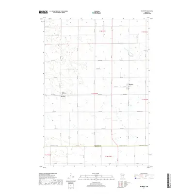
2019 Map of Blomkest
USGS Topo · Published 2019About this map
Roseland and Blomkest anchor this agricultural landscape in southern Kandiyohi County during the late 2010s. The region is defined by its rectilinear road grid and essential water management systems, notably County Ditch Number Eight A which snakes through the northeastern sections. This map is particularly valuable for genealogists and local historians, as it precisely identifies the Roseland Christian Reformed Cem and the Blomkest Cem. The southern boundary of the map follows the Kandiyohi Co Renville Co line, where the local transportation network transitions into Renville County. The dense network of numbered roads, such as 195th Ave SW and Kandiyohi Co Rd 122, illustrates the modern connectivity of this rural farming community.
Find a feature on this map
39 named features on this map. Tap any name to fly to it.
Don’t see what you’re looking for? This feature index may not catch every label — zoom into the map to look around manually.
Map Details
Editions of this 2019 Blomkest Map
This is the sole edition of this map. No revisions or reprints were ever made.
Other maps of this area

1953 · New Ulm
USGS Topo · 1:250,000

1953 · Saint Cloud
USGS Topo · 1:250,000

1956 · Atwater
USGS Topo · 1:62,500

1957 · Saint Cloud
USGS Topo · 1:250,000

1957 · New Ulm
USGS Topo · 1:250,000

1957 · Olivia
USGS Topo · 1:62,500

1958 · New Ulm
USGS Topo · 1:250,000

1958 · Saint Cloud
USGS Topo · 1:250,000

1958 · Raymond
USGS Topo · 1:24,000

1958 · Willmar
USGS Topo · 1:24,000