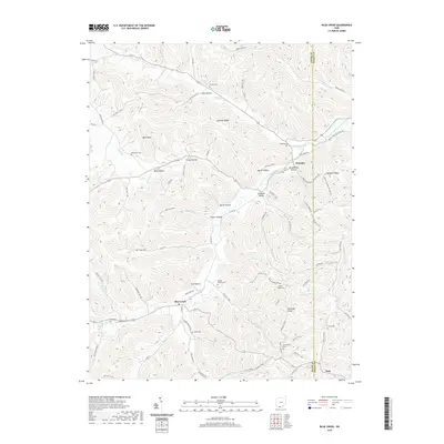
2019 Map of Blue Creek
USGS Topo · Published 2019About this map
The ridge-and-hollow topography of the Adams Co and Scioto Co borderland defines this section of southern Ohio. Settlement is concentrated along the narrow valley floors of South Fork Scioto Brush Creek and Mill Cr, where the community of Blue Creek serves as a local hub. The landscape is dotted with small family and community burial grounds like Antioch Cem and Winterstein Cem, reflecting generations of rural inhabitancy. The Buckeye Trail winds through the southern portion of the map, traversing Mt Unger Ridge and crossing Hull Fork. This modern survey details the persistent rural character of the region, from the high point at Behm Mtn to the many named hollows such as Spires Hollow and Groundhog Hollow that branch off the primary drainage networks.
Find a feature on this map
98 named features on this map. Tap any name to fly to it.
Don’t see what you’re looking for? This feature index may not catch every label — zoom into the map to look around manually.
Map Details
Editions of this 2019 Blue Creek Map
This is the sole edition of this map. No revisions or reprints were ever made.
Other maps of this area

1915 · Garrison
USGS Topo · 1:62,500

1915 · Otway
USGS Topo · 1:62,500

1916 · Peebles
USGS Topo · 1:62,500

1917 · Otway
USGS Topo · 1:62,500

1918 · Garrison
USGS Topo · 1:62,500

1918 · Peebles
USGS Topo · 1:62,500

1919 · Vanceburg
USGS Topo · 1:62,500

1949 · Pond Run
USGS Topo · 1:24,000

1949 · Vanceburg
USGS Topo · 1:62,500

1949 · Buena Vista
USGS Topo · 1:24,000