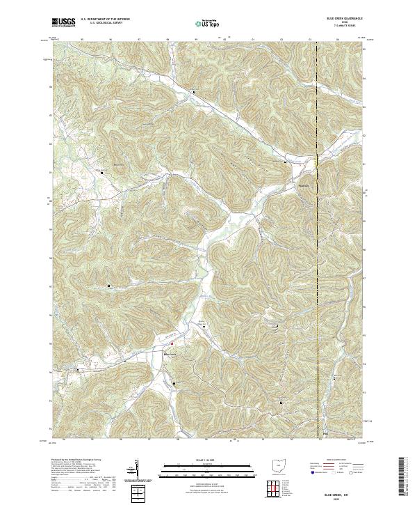
2023 Map of Blue Creek
USGS Topo · Published 2023About this map
Wamsley and the surrounding hollows of eastern Adams County are defined by a complex network of ridges and watercourses, documented here in the early 2020s. The landscape is structured by prominent elevations like Behm Mtn and Coleman Ridge, with settlements clustered near the intersections of township roads and creek beds. For genealogists, the map preserves the locations of numerous family and community burial grounds, including Moores Chapel Cem, Antioch Cem, and Wintersteen Cem. The drainage patterns are intricate, with South Fork Scioto Brush Creek and Turkey Creek serving as primary arteries for many smaller runs and branches such as Cassel Run and Walker Run. This modern survey records the enduring rural character of the region, from the small community at Blue Creek to the high ground of Mount Unger Ridge.
Find a feature on this map
95 named features on this map. Tap any name to fly to it.
Don’t see what you’re looking for? This feature index may not catch every label — zoom into the map to look around manually.
Map Details
Editions of this 2023 Blue Creek Map
This is the sole edition of this map. No revisions or reprints were ever made.
Other maps of this area

1915 · Garrison
USGS Topo · 1:62,500

1915 · Otway
USGS Topo · 1:62,500

1916 · Peebles
USGS Topo · 1:62,500

1917 · Otway
USGS Topo · 1:62,500

1918 · Garrison
USGS Topo · 1:62,500

1918 · Peebles
USGS Topo · 1:62,500

1919 · Vanceburg
USGS Topo · 1:62,500

1949 · Pond Run
USGS Topo · 1:24,000

1949 · Vanceburg
USGS Topo · 1:62,500

1949 · Buena Vista
USGS Topo · 1:24,000