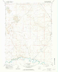
1961 Map of Blue Point
USGS Topo · Published 1973About this map
The Overland Trail and the Emigrant Trail converge near the winding path of Blacks Fork in this 1961 survey of Sweetwater County. This landscape preserves a physical record of westward migration, where the historical routes of pioneers intersect with the modern industrial footprint of the Union Pacific railroad and the Westvaco site. The topography is defined by significant draws and points, notably Eckes Draw and the prominent Blue Point, which offered natural landmarks for early travelers.
Find a feature on this map
12 named features on this map. Tap any name to fly to it.
Don’t see what you’re looking for? This feature index may not catch every label — zoom into the map to look around manually.
Map Details
Editions of this 1961 Blue Point Map
3 editions found
Other maps of this area

1954 · Rock Springs
USGS Topo · 1:250,000

1958 · Rock Springs
USGS Topo · 1:250,000

1961 · Blue Point
USGS Topo · 1:24,000

1961 · Little America
USGS Topo · 1:24,000

1961 · Sevenmile Gulch
USGS Topo · 1:24,000

1961 · Granger
USGS Topo · 1:24,000

1961 · Stevens Flat
USGS Topo · 1:24,000

1961 · Bryan
USGS Topo · 1:24,000

1962 · Rock Springs
USGS Topo · 1:250,000

1963 · Big Island Bridge
USGS Topo · 1:24,000