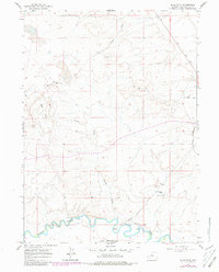
1961 Map of Blue Point
USGS Topo · Published 1980About this map
The Blacks Fork meanders across the southern landscape of this 1961 survey, where the arrival of industrial mining and historical western passage routes converge. Traces of the Emigrant Trail and the Overland Trail cross the high plateau, marking the path of 19th-century westward migration. The presence of Soda Ash Wells and the Union Pacific-Westvaco line indicates the region's mid-century transition into a hub for trona mining and chemical production. Scattered remnants of earlier settlement remain visible, including the Eckes Homestead near the river and several Aqueducts (Aban'd). The terrain is defined by prominent features like Blue Point and Big Island, while Eckes Draw and Demming Draw carve through the arid Sweetwater County uplands. This map, updated with 1970s aerial photography, captures a moment when traditional ranching footprints and historic trails existed alongside expanding industrial infrastructure.
Find a feature on this map
18 named features on this map. Tap any name to fly to it.
Don’t see what you’re looking for? This feature index may not catch every label — zoom into the map to look around manually.
Map Details
Editions of this 1961 Blue Point Map
3 editions found
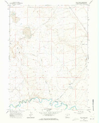
Other maps of this area

1954 · Rock Springs
USGS Topo · 1:250,000

1958 · Rock Springs
USGS Topo · 1:250,000

1961 · Blue Point
USGS Topo · 1:24,000

1961 · Little America
USGS Topo · 1:24,000

1961 · Sevenmile Gulch
USGS Topo · 1:24,000

1961 · Granger
USGS Topo · 1:24,000

1961 · Stevens Flat
USGS Topo · 1:24,000

1961 · Bryan
USGS Topo · 1:24,000

1962 · Rock Springs
USGS Topo · 1:250,000

1963 · Big Island Bridge
USGS Topo · 1:24,000