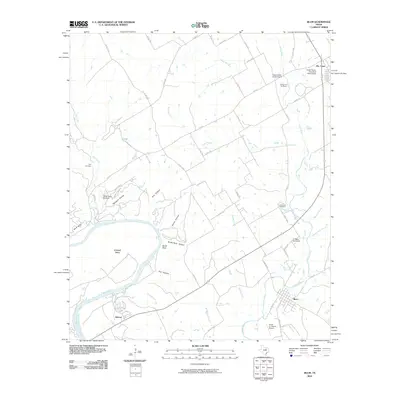
2010 Map of Blum
USGS Topo · Published 2010About this map
The Brazos River carves a deep loop at Kimball Bend in this Johnson County landscape, where the water has shaped the rugged local terrain into series of named drainages like Owl Hollow and Broke Rock Hollow. The confluence of the Nolan River and the Brazos anchors the southern half of the quadrangle near the community of Blum. This area serves as a transition from the river bottomlands to the upland prairie, marked by private aviation sites like the Smith Ranch-First State Bank Airport and the Circle 'A' Ranch Airport.
Find a feature on this map
56 named features on this map. Tap any name to fly to it.
Don’t see what you’re looking for? This feature index may not catch every label — zoom into the map to look around manually.
Map Details
Editions of this 2010 Blum Map
This is the sole edition of this map. No revisions or reprints were ever made.
Other maps of this area

1889 · Granbury
USGS Topo · 1:125,000

1891 · Cleburne
USGS Topo · 1:125,000

1894 · Cleburne
USGS Topo · 1:125,000

1924 · Cleburne 3-B
USGS Topo · 1:48,000

1924 · Cleburne 3-C
USGS Topo · 1:48,000

1924 · Granbury 4-a
USGS Topo · 1:48,000

1927 · Blum
USGS Topo · 1:62,500

1928 · Godley
USGS Topo · 1:62,500

1931 · Morgan
USGS Topo · 1:62,500

1954 · Dallas
USGS Topo · 1:250,000