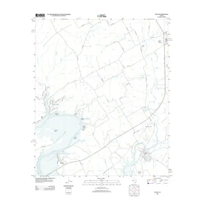
2012 Map of Blum
USGS Topo · Published 2012About this map
The Brazos River carves a sweeping arc through this North Texas landscape, defining the topography with its deep curves and numerous hollows. Along its northern banks, the terrain is pocketed by Opossum Hollow and Elm Hollow, leading toward the prominent Kimball Bend. This 2012 survey captures the rural character of the region, where the Nolan River flows south to join the Brazos, passing through the town of Blum.
Find a feature on this map
83 named features on this map. Tap any name to fly to it.
Don’t see what you’re looking for? This feature index may not catch every label — zoom into the map to look around manually.
Map Details
Editions of this 2012 Blum Map
This is the sole edition of this map. No revisions or reprints were ever made.
Other maps of this area

1889 · Granbury
USGS Topo · 1:125,000

1891 · Cleburne
USGS Topo · 1:125,000

1894 · Cleburne
USGS Topo · 1:125,000

1924 · Cleburne 3-B
USGS Topo · 1:48,000

1924 · Cleburne 3-C
USGS Topo · 1:48,000

1924 · Granbury 4-a
USGS Topo · 1:48,000

1927 · Blum
USGS Topo · 1:62,500

1928 · Godley
USGS Topo · 1:62,500

1931 · Morgan
USGS Topo · 1:62,500

1954 · Dallas
USGS Topo · 1:250,000