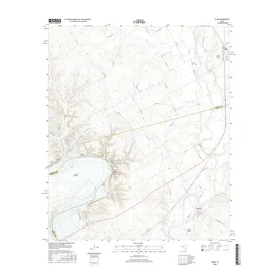
2016 Map of Blum
USGS Topo · Published 2016About this map
The Brazos River carves a massive, distinctive loop known as Kimball Bend at the intersection of Johnson, Hill, and Bosque Counties. This riverine landscape is defined by its dramatic hydrology and topography, featuring numerous creek drainages like Belknap Cr and Nolan River, alongside named terrain features such as Broke Rock Hollow and Opossum Hollow. The settlement of Blum serves as a local hub in the southeast, while Rio Vista occupies the northeastern corner, supported by the Lowell Smith Jr Airport.
Find a feature on this map
49 named features on this map. Tap any name to fly to it.
Don’t see what you’re looking for? This feature index may not catch every label — zoom into the map to look around manually.
Map Details
Editions of this 2016 Blum Map
This is the sole edition of this map. No revisions or reprints were ever made.
Other maps of this area

1889 · Granbury
USGS Topo · 1:125,000

1891 · Cleburne
USGS Topo · 1:125,000

1894 · Cleburne
USGS Topo · 1:125,000

1924 · Cleburne 3-B
USGS Topo · 1:48,000

1924 · Cleburne 3-C
USGS Topo · 1:48,000

1924 · Granbury 4-a
USGS Topo · 1:48,000

1927 · Blum
USGS Topo · 1:62,500

1928 · Godley
USGS Topo · 1:62,500

1931 · Morgan
USGS Topo · 1:62,500

1954 · Dallas
USGS Topo · 1:250,000