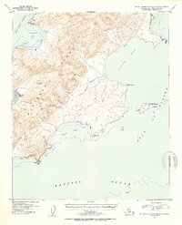
1953 Map of Blying Sound D-1 and D-2
USGS Topo · Published 1954About this map
Montague Island dominates this mid-century maritime survey, situated where the Montague Strait meets the Gulf of Alaska. Entirely contained within the Chugach National Forest, the island’s southern reaches are depicted with topographic precision, revealing the complex shoreline of Hanning Bay and the deep indentation of Mac Leod Harbor. A lone Cabin near Pt Bazil represents one of the few signs of human habitation in this isolated coastal wilderness.
Find a feature on this map
18 named features on this map. Tap any name to fly to it.
Don’t see what you’re looking for? This feature index may not catch every label — zoom into the map to look around manually.
Map Details
Editions of this 1953 Blying Sound D-1 and D-2 Map
2 editions found
Other maps of this area

1946 · Blying Sound
USGS Topo · 1:250,000

1951 · Blying Sound
USGS Topo · 1:250,000

1951 · Seward
USGS Topo · 1:250,000

1951 · Seward A-2
USGS Topo · 1:63,360

1951 · Seward A-3
USGS Topo · 1:63,360

1951 · Blying Sound D-1 and D-2
USGS Topo · 1:63,360

1951 · Seward A-1
USGS Topo · 1:63,360

1952 · Seward A-3
USGS Topo · 1:63,360

1953 · Seward A-2
USGS Topo · 1:63,360

1953 · Seward A-1
USGS Topo · 1:63,360