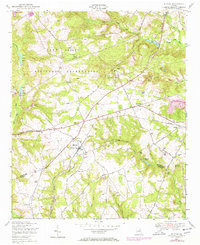
1948 Map of Blythe
USGS Topo · Published 1972About this map
The Fort Gordon Military Reservation dominates the northern half of this landscape, its boundary cutting a sharp line through the rural terrain of Richmond and Burke Counties. At the intersection of Louisville Road and Bath Road, the settlement of Blythe serves as a local hub, featuring Blythe High School and numerous surrounding family cemeteries such as Rachels and Saxon.
Find a feature on this map
48 named features on this map. Tap any name to fly to it.
Don’t see what you’re looking for? This feature index may not catch every label — zoom into the map to look around manually.
Map Details
Editions of this 1948 Blythe Map
4 editions found
Other maps of this area

1919 · Gough
USGS Topo · 1:62,500

1920 · Stapleton
USGS Topo · 1:62,500

1922 · Harlem
USGS Topo · 1:62,500

1922 · Hephzibah
USGS Topo · 1:62,500

1948 · Hephzibah
USGS Topo · 1:62,500

1948 · Harlem
USGS Topo · 1:62,500

1948 · Stapleton
USGS Topo · 1:62,500

1948 · Gough
USGS Topo · 1:62,500

1948 · Blythe
USGS Topo · 1:24,000

1948 · Harlem
USGS Topo · 1:24,000