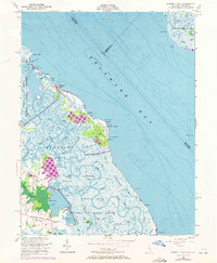
1956 Map of Bombay Hook
USGS Topo · Published 1972About this map
The expansive salt marshes and tidal guts of Bombay Hook National Wildlife Refuge define this coastal landscape along the Delaware Bay. The map documents a fragile ecosystem dominated by Bombay Hook Island and extensive wetlands like Leatherberry Flats and Bear Swamp. Managed water levels are evident at Raymond Pool and Shearness Pool, while the presence of ruins near Woodland Beach suggests the changing footprint of human habitation along the shore.
Find a feature on this map
56 named features on this map. Tap any name to fly to it.
Don’t see what you’re looking for? This feature index may not catch every label — zoom into the map to look around manually.
Map Details
Editions of this 1956 Bombay Hook Map
4 editions found

Other maps of this area

1890 · Bay Side
USGS Topo · 1:62,500

1894 · Bay Side
USGS Topo · 1:62,500

1899 · Vineland
USGS Topo · 1:125,000

1899 · Dover
USGS Topo · 1:125,000

1906 · Dover
USGS Topo · 1:125,000

1919 · Vineland
USGS Topo · 1:125,000

1920 · Dover
USGS Topo · 1:125,000

1926 · Wyoming
USGS Topo · 1:48,000

1930 · Wyoming
USGS Topo · 1:62,500

1931 · Wyoming
USGS Topo · 1:62,500