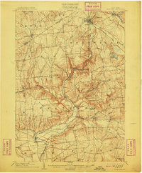
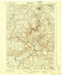
1904 Map of Boonville
USGS Topo · Published 1910About this map
The Black River Canal serves as a dominant industrial corridor through Oneida County in the early twentieth century, accompanied by its associated Feeder and the Black River itself. This waterway infrastructure was critical to the economic life of Boonville, which appears here as a significant regional hub complete with the Boonville Reservoir and a connection to the N. Y. C. and H. R. R. R. (Utica Line). The landscape is defined by its numerous family-named peaks and ridges, such as Potato Hill, Webster Hill, and Tripp Pinnacle, which dictate the winding paths of the Mohawk River and its various branches.
Find a feature on this map
77 named features on this map. Tap any name to fly to it.
Don’t see what you’re looking for? This feature index may not catch every label — zoom into the map to look around manually.
Map Details
Editions of this 1904 Boonville Map
6 editions found
Other maps of this area

1895 · Oriskany
USGS Topo · 1:62,500

1895 · Oneida
USGS Topo · 1:62,500

1897 · Remsen
USGS Topo · 1:62,500

1898 · Oneida
USGS Topo · 1:62,500

1898 · Utica
USGS Topo · 1:62,500

1898 · Oriskany
USGS Topo · 1:62,500

1900 · Utica
USGS Topo · 1:62,500

1900 · Remsen
USGS Topo · 1:62,500

1902 · Oneida
USGS Topo · 1:62,500

1904 · Boonville
USGS Topo · 1:62,500