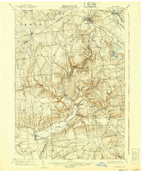
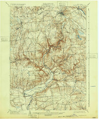
1904 Map of Boonville
USGS Topo · Published 1939About this map
Boonville serves as the central hub of this northern Oneida County landscape at the beginning of the twentieth century, where the Black River Canal and the N. Y. C. and H. R. R. R. (Utica Line) converge. The map illustrates a complex water management system crucial to early New York commerce, including the Canal Feeder and the Boonville Reservoir. To the south and west, the terrain rises into prominent ridges such as Quaker Hill and Webster Hill, which hem in the winding courses of the Mohawk River and Lansing Kill.
Find a feature on this map
63 named features on this map. Tap any name to fly to it.
Don’t see what you’re looking for? This feature index may not catch every label — zoom into the map to look around manually.
Map Details
Editions of this 1904 Boonville Map
6 editions found
Other maps of this area

1895 · Oriskany
USGS Topo · 1:62,500

1895 · Oneida
USGS Topo · 1:62,500

1897 · Remsen
USGS Topo · 1:62,500

1898 · Oneida
USGS Topo · 1:62,500

1898 · Utica
USGS Topo · 1:62,500

1898 · Oriskany
USGS Topo · 1:62,500

1900 · Utica
USGS Topo · 1:62,500

1900 · Remsen
USGS Topo · 1:62,500

1902 · Oneida
USGS Topo · 1:62,500

1904 · Boonville
USGS Topo · 1:62,500