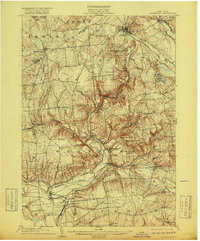
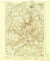
1904 Map of Boonville
USGS Topo · Published 1918About this map
The Black River Canal and the N. Y. C. and H. R. R. R. converge at Boonville, illustrating a critical juncture of early 20th-century transportation in the Mohawk Valley foothills. This landscape is defined by the steep descent of the Lansing Kill and numerous family-named peaks such as Webster Hill and Buck Hill. Near the Mohawk River, the village of Delta is shown in its entirety, providing a rare look at the community before it was submerged by the construction of the Delta Dam shortly after this survey. The map meticulously documents the transition from lowland river valleys to the uplifted plateau, marking small agrarian settlements like Westernville, Frenchville, and West Leyden along the Lewis and Oneida County line. Researchers will find significant genealogical detail in the placement of South Hill Church and the scattered farmsteads across Quaker Hill.
Find a feature on this map
64 named features on this map. Tap any name to fly to it.
Don’t see what you’re looking for? This feature index may not catch every label — zoom into the map to look around manually.
Map Details
Editions of this 1904 Boonville Map
6 editions found
Other maps of this area

1895 · Oriskany
USGS Topo · 1:62,500

1895 · Oneida
USGS Topo · 1:62,500

1897 · Remsen
USGS Topo · 1:62,500

1898 · Oneida
USGS Topo · 1:62,500

1898 · Utica
USGS Topo · 1:62,500

1898 · Oriskany
USGS Topo · 1:62,500

1900 · Utica
USGS Topo · 1:62,500

1900 · Remsen
USGS Topo · 1:62,500

1902 · Oneida
USGS Topo · 1:62,500

1904 · Boonville
USGS Topo · 1:62,500