
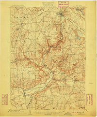
1904 Map of Boonville
USGS Topo · Published 1904This historical map portrays the area of Boonville in 1904, primarily covering Oneida County as well as portions of Lewis County. Featuring a scale of 1:62500, this map provides a highly detailed snapshot of the terrain, roads, buildings, counties, and historical landmarks in the Boonville region at the time. Published in 1904, it is one of 6 known editions of this map due to revisions or reprints.
Find a feature on this map
62 named features on this map. Tap any name to fly to it.
Don’t see what you’re looking for? This feature index may not catch every label — zoom into the map to look around manually.
Map Details
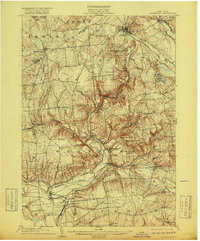
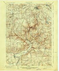
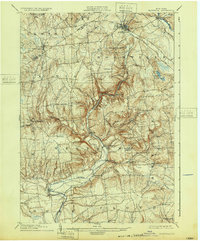
Editions of this 1904 Boonville Map
6 editions found
Historical Maps of Elmer Hill Through Time
42 maps found

1897 Remsen
Oneida County, NY

1900 Remsen
Oneida County, NY

1904 Boonville
Oneida County, NY

1905 Taberg
Oneida County, NY

1941 Jewell
Oneida County, NY

1943 Camden East
Oneida County, NY

1943 Camden West
Oneida County, NY

1943 Cassville
Oneida County, NY

1943 East Florence
Oneida County, NY

1943 Lee Center
Oneida County, NY

1943 Westdale
Oneida County, NY

1944 Jewell
Oneida County, NY

1945 Boonville
Oneida County, NY

1945 Cassville
Oneida County, NY

1945 Forestport
Oneida County, NY

1945 South Trenton
Oneida County, NY

1946 Remsen
Oneida County, NY

1946 Westdale
Oneida County, NY

1946 West Leyden
Oneida County, NY

1947 Boonville
Oneida County, NY

1947 Forestport
Oneida County, NY

1947 North Western
Oneida County, NY

1947 Remsen
Oneida County, NY

1947 West Leyden
Oneida County, NY

1948 Vernon
Oneida County, NY

1948 Verona
Oneida County, NY

1949 Utica West
Oneida County, NY

1955 Boonville
Oneida County, NY

1955 Camden East
Oneida County, NY

1955 Florence
Oneida County, NY

1955 Lee Center
Oneida County, NY

1955 North Western
Oneida County, NY

1955 Remsen
Oneida County, NY

1955 South Trenton
Oneida County, NY

1955 Utica West
Oneida County, NY

1955 Vernon
Oneida County, NY

1955 Verona
Oneida County, NY

1955 West Leyden
Oneida County, NY

1957 Jewell
Oneida County, NY

1959 Westdale
Oneida County, NY

1960 Camden West
Oneida County, NY

1983 South Trenton
Oneida County, NY