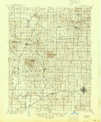
1902 Map of Boonville
USGS Topo · Published 1946About this map
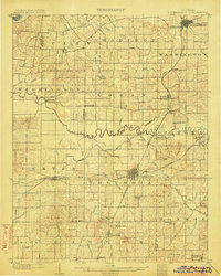
Boonville serves as the primary hub in this turn-of-the-century survey, anchoring a landscape defined by its transition from water-based transport to rail. The northern reaches of the Canal (Abandoned) and the Millersburg Canal indicate an earlier era of commerce, while the Evansville Division and the Indianapolis and Evansville Division of the Southern Railway highlight the emerging industrial connectivity of the time. The topography is marked by distinct rises such as Big Ditney Hill and Dyson Knob, which break the drainage patterns of Pigeon Creek and Squaw Creek. Scattered rural settlements like Elberfeld, Lynnville, and Buckskin show the established agricultural footprint of Warrick and Gibson counties, while smaller locales like Wheatonville and Daylight provide specific points of interest for those tracing family roots in southwestern Indiana.
Find a feature on this map
56 named features on this map. Tap any name to fly to it.
Don’t see what you’re looking for? This feature index may not catch every label — zoom into the map to look around manually.
Map Details
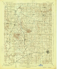
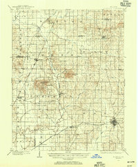
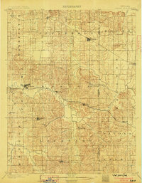
Editions of this 1902 Boonville Map
4 editions found
Other maps of this area

1900 · De Gonia Springs
USGS Topo · 1:62,500

1901 · Owensboro
USGS Topo · 1:62,500

1901 · Princeton
USGS Topo · 1:62,500

1901 · Haubstadt
USGS Topo · 1:62,500

1902 · Ditney
USGS Topo · 1:125,000

1902 · Degonia Springs
USGS Topo · 1:62,500

1902 · Boonville
USGS Topo · 1:62,500
1903 · Velpen
USGS Topo · 1:62,500

1903 · Haubstadt
USGS Topo · 1:62,500
1903 · Petersburg
USGS Topo · 1:62,500