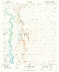
1950 Map of Bottomless Lakes
USGS Topo · Published 1968About this map
Bottomless Lakes State Park highlights a unique geological landscape east of the Pecos River, where deep artesian cenotes create a striking contrast against the arid Chaves County terrain. This mid-century survey, based on 1947 aerial photography and 1950 fieldwork, documents the clustered lakes of the escarpment, including Mirror Lake, Inkwell Lake, and the expansive Lea Lake. The map reveals the area's transition between recreational use and natural resource extraction, noting the Fin and Feather Club alongside several Oil Wells (Aban'd) and a Pumping Station. Ranching legacy is evident through family-named sites like Ervin Ranch, Atkinson Ranch, and Greenwood Ranch. To the west, the managed water systems of the Hagerman Canal run parallel to the river's winding path, illustrating the vital irrigation infrastructure that sustained agriculture in this part of New Mexico.
Find a feature on this map
22 named features on this map. Tap any name to fly to it.
Don’t see what you’re looking for? This feature index may not catch every label — zoom into the map to look around manually.
Map Details
Editions of this 1950 Bottomless Lakes Map
4 editions found
Other maps of this area

1949 · Wade Ranch
USGS Topo · 1:24,000

1949 · L-E Ranch
USGS Topo · 1:24,000

1950 · Dexter West
USGS Topo · 1:24,000

1950 · Comanche Spring
USGS Topo · 1:24,000

1950 · Bottomless Lakes
USGS Topo · 1:24,000

1950 · South Spring
USGS Topo · 1:24,000

1950 · Bitter Lake
USGS Topo · 1:24,000

1950 · Dexter East
USGS Topo · 1:24,000

1952 · Bar C Bar Ranch
USGS Topo · 1:24,000

1955 · Roswell
USGS Topo · 1:250,000