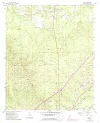
1974 Map of Boyd
USGS Topo · Published 1987About this map
Sucarnoochee River winds through the northern half of this Alabama landscape, creating a complex drainage network that includes Ponta Creek and Edmond Branch. The settlement pattern is defined by rural centers like Payneville and Millville, alongside family and community landmarks such as Elliott Cem and Smiths Chapel. The southern edge of the map shows the transition into more developed areas near York, featuring the Southern railroad line and recreational sites like the Sumter Country Club.
Find a feature on this map
36 named features on this map. Tap any name to fly to it.
Don’t see what you’re looking for? This feature index may not catch every label — zoom into the map to look around manually.
Map Details
Editions of this 1974 Boyd Map
2 editions found
Other maps of this area

1929 · Epes
USGS Topo · 1:48,000

1932 · Epes
USGS Topo · 1:62,500

1953 · Meridian
USGS Topo · 1:250,000

1957 · Meridian
USGS Topo · 1:250,000

1965 · Meridian
USGS Topo · 1:250,000

1971 · Bellamy
USGS Topo · 1:24,000

1974 · Boyd
USGS Topo · 1:24,000
1974 · Tamola
USGS Topo · 1:24,000
1974 · Epes West
USGS Topo · 1:24,000
1974 · Emelle
USGS Topo · 1:24,000