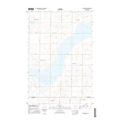
2017 Map of Braddock NW
USGS Topo · Published 2017About this map
Long Lake dominates this central North Dakota landscape, stretching across the townships of the Burleigh County and Emmons County border. This section of the Missouri Plateau is defined by the expansive wetland and water system where Long Lake Creek (also labeled Long Lake Cr) flows into the southern basin. The terrain is a characteristic mix of open water and prairie potholes, typical of the regional topography east of the Missouri River.
Find a feature on this map
16 named features on this map. Tap any name to fly to it.
Don’t see what you’re looking for? This feature index may not catch every label — zoom into the map to look around manually.
Map Details
Editions of this 2017 Braddock NW Map
This is the sole edition of this map. No revisions or reprints were ever made.
Other maps of this area

1951 · McKenzie
USGS Topo · 1:62,500

1951 · Driscoll
USGS Topo · 1:62,500

1954 · Bismarck
USGS Topo · 1:250,000

1958 · Bismarck
USGS Topo · 1:250,000

1971 · Moffit SE
USGS Topo · 1:24,000

1971 · Moffit
USGS Topo · 1:24,000

1975 · Sterling
USGS Topo · 1:24,000

1975 · Lake Geneva
USGS Topo · 1:24,000
1975 · Driscoll
USGS Topo · 1:24,000

1975 · Dana
USGS Topo · 1:24,000