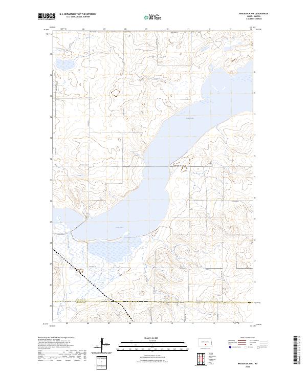
2024 Map of Braddock NW
USGS Topo · Published 2024About this map
Long Lake National Wildlife Refuge dominates this stretch of the northern Great Plains, protecting a vital water system that spans the border between Burleigh Co and Emmons Co. The expansive waters of Long Lake and its associated wetlands are fed by Long Lake Creek, creating a critical sanctuary for migratory birds within the Missouri Coteau landscape. The area is defined by its rectilinear section lines and a sparse grid of rural roads, including 128th Ave SE and 405th St SE, which provide access to the surrounding agricultural uplands. This survey documents the modern management of these prairie wetlands, showing the intricate shoreline and drainage patterns that characterize the refuge's interior today.
Find a feature on this map
26 named features on this map. Tap any name to fly to it.
Don’t see what you’re looking for? This feature index may not catch every label — zoom into the map to look around manually.
Map Details
Editions of this 2024 Braddock NW Map
This is the sole edition of this map. No revisions or reprints were ever made.
Other maps of this area

1951 · McKenzie
USGS Topo · 1:62,500

1951 · Driscoll
USGS Topo · 1:62,500

1954 · Bismarck
USGS Topo · 1:250,000

1958 · Bismarck
USGS Topo · 1:250,000

1971 · Moffit SE
USGS Topo · 1:24,000

1971 · Moffit
USGS Topo · 1:24,000

1975 · Sterling
USGS Topo · 1:24,000

1975 · Lake Geneva
USGS Topo · 1:24,000
1975 · Driscoll
USGS Topo · 1:24,000

1975 · Dana
USGS Topo · 1:24,000