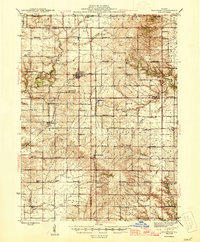
1945 Map of Bradford
USGS Topo · Published 1945About this map
Bradford and its surrounding prairie townships of Osceola, Milo, and Penn are depicted here during the mid-1940s, revealing a landscape defined by an exceptionally dense network of rural schoolhouses. Nearly every section contains a named local school, such as Harty Sch, Evergreen Sch, and Pleasant Drink Sch, illustrating the decentralized social structure of Illinois farming communities before modern district consolidation. The transportation grid is anchored by the Chicago and North Western and Chicago Rock Island and Pacific railroads, which facilitated the growth of shipping points like Lombardville and Broadmoor. Significant family and community history is preserved in the location of sites like Valley Grove Camp and the Pleasant View Cem, while the winding courses of Senachwine Creek and Crow Creek provide the primary natural relief against the systematic agricultural survey lines.
Find a feature on this map
80 named features on this map. Tap any name to fly to it.
Don’t see what you’re looking for? This feature index may not catch every label — zoom into the map to look around manually.
Map Details
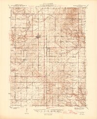
Editions of this 1945 Bradford Map
3 editions found

Other maps of this area

1893 · Lacon
USGS Topo · 1:62,500

1893 · Hennepin
USGS Topo · 1:62,500

1893 · Metamora
USGS Topo · 1:62,500

1893 · Dunlap
USGS Topo · 1:62,500

1898 · Dunlap
USGS Topo · 1:62,500

1909 · Hennepin
USGS Topo · 1:62,500

1911 · Hennepin
USGS Topo · 1:62,500

1921 · Buda
USGS Topo · 1:62,500

1923 · Buda
USGS Topo · 1:62,500

1929 · Annawan
USGS Topo · 1:62,500