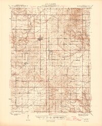
1945 Map of Bradford
USGS Topo · Published 1945About this map
Bradford serves as the central hub of this agricultural landscape at the intersection of Stark, Bureau, and Marshall counties. The mid-century rural character is defined by a dense network of country schools, including Pleasant Mound Sch and Logan Sch, located at nearly every section interval to serve the surrounding farmstead families. Transport is anchored by the Chicago Burlington and Quincy and Chicago and Northwestern railroads, which facilitated the movement of grain and livestock from settlements like Lombardville and Camp Grove. Numerous small family and community burial grounds, such as St Johns Cem and Eagleston Cem, are preserved across the townships. The drainage of the land is visible through the winding courses of Spoon River and Senachwine Creek, which carve through the prairie to define the local topography and historical property lines.
Find a feature on this map
83 named features on this map. Tap any name to fly to it.
Don’t see what you’re looking for? This feature index may not catch every label — zoom into the map to look around manually.
Map Details
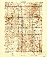
Editions of this 1945 Bradford Map
3 editions found

Other maps of this area

1893 · Lacon
USGS Topo · 1:62,500

1893 · Hennepin
USGS Topo · 1:62,500

1893 · Metamora
USGS Topo · 1:62,500

1893 · Dunlap
USGS Topo · 1:62,500

1898 · Dunlap
USGS Topo · 1:62,500

1909 · Hennepin
USGS Topo · 1:62,500

1911 · Hennepin
USGS Topo · 1:62,500

1921 · Buda
USGS Topo · 1:62,500

1923 · Buda
USGS Topo · 1:62,500

1929 · Annawan
USGS Topo · 1:62,500