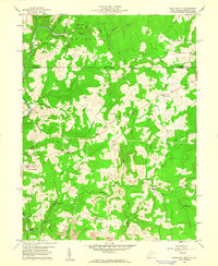
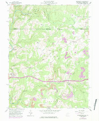
1959 Map of Brandonville
USGS Topo · Published 1960About this map
Brandonville and the surrounding hill country of Preston County sit at the center of this late-1950s survey, illustrating a landscape defined by small crossroads settlements and the early extractive industry. The map captures a period of transition where traditional rural landmarks like the Salem Sch and Locust Grove Ch stand alongside growing industrial signatures. Evidence of coal production is widespread south of the town, where numerous Strip Mine operations and individual Mine sites follow the contours above Little Sandy Creek.
Find a feature on this map
43 named features on this map. Tap any name to fly to it.
Don’t see what you’re looking for? This feature index may not catch every label — zoom into the map to look around manually.
Map Details
Editions of this 1959 Brandonville Map
6 editions found
Other maps of this area

1900 · Accident
USGS Topo · 1:62,500

1900 · Uniontown
USGS Topo · 1:62,500

1904 · Bruceton
USGS Topo · 1:62,500

1922 · Confluence
USGS Topo · 1:62,500

1926 · Bruceton
USGS Topo · 1:62,500

1931 · Uniontown
USGS Topo · 1:62,500

1931 · Confluence
USGS Topo · 1:62,500

1931 · Bruceton Mills
USGS Topo · 1:62,500

1933 · Confluence
USGS Topo · 1:62,500

1933 · Bruceton
USGS Topo · 1:62,500