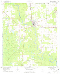
1968 Map of Branford
USGS Topo · Published 1977About this map
The Suwannee River carves a winding path through this North Florida landscape, defining the borders of Suwannee, Lafayette, and Gilchrist counties. The town of Branford serves as a central hub, situated where the Seaboard Coast Line railroad crosses the river. This 1960s survey documents a rural environment shaped by the river's hydrology and the local rail economy, featuring the small settlement of Grady and a Gaging Sta downstream from the main town center.
Find a feature on this map
18 named features on this map. Tap any name to fly to it.
Don’t see what you’re looking for? This feature index may not catch every label — zoom into the map to look around manually.
Map Details
Editions of this 1968 Branford Map
3 editions found

Other maps of this area

1954 · Mallory Swamp SE
USGS Topo · 1:24,000

1954 · Mallory Swamp NE
USGS Topo · 1:24,000

1954 · Gainesville
USGS Topo · 1:250,000

1954 · Valdosta
USGS Topo · 1:250,000

1955 · Mayo SE
USGS Topo · 1:24,000

1956 · Mallory Swamp SE
USGS Topo · 1:25,000

1958 · Valdosta
USGS Topo · 1:250,000

1958 · Gainesville
USGS Topo · 1:250,000

1959 · Valdosta
USGS Topo · 1:250,000

1959 · Gainesville
USGS Topo · 1:250,000