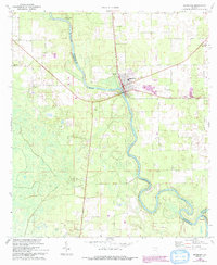
1968 Map of Branford
USGS Topo · Published 1993About this map
The Suwannee River carves a winding path through this North Florida landscape, defining the boundaries between Suwannee, Lafayette, and Gilchrist counties. This 1968 field-checked survey reveals a rural community centered on the town of Branford, where the river meets the primary highway. The area is marked by a high density of country churches and family burial grounds, including Mt Paran Ch, Ephesus Ch, and Oak Grove Cem, reflecting the deep-rooted settlement patterns of the Suwannee Valley. Notable natural features like Little River Springs appear alongside small river-adjacent settlements such as Grady and Wanamake. Human activity on the landscape is further evidenced by a local Quarry, a Landing Strip, and the confluence where the Santa Fe River joins the Suwannee at the southern edge of the quadrangle.
Find a feature on this map
21 named features on this map. Tap any name to fly to it.
Don’t see what you’re looking for? This feature index may not catch every label — zoom into the map to look around manually.
Map Details
Editions of this 1968 Branford Map
3 editions found

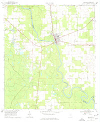
Other maps of this area

1954 · Mallory Swamp SE
USGS Topo · 1:24,000

1954 · Mallory Swamp NE
USGS Topo · 1:24,000

1954 · Gainesville
USGS Topo · 1:250,000

1954 · Valdosta
USGS Topo · 1:250,000

1955 · Mayo SE
USGS Topo · 1:24,000

1956 · Mallory Swamp SE
USGS Topo · 1:25,000

1958 · Valdosta
USGS Topo · 1:250,000

1958 · Gainesville
USGS Topo · 1:250,000

1959 · Valdosta
USGS Topo · 1:250,000

1959 · Gainesville
USGS Topo · 1:250,000