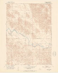
1952 Map of Brewster
USGS Topo · Published 1954About this map
The North Loup River meanders across this mid-century landscape, providing a critical water source for the cattle operations that define the region. The settlement of Brewster sits on the northern bank, serving as a focal point for local history along with the nearby Brewster Cem. The map illustrates the sparse, ranch-oriented settlement patterns of the Nebraska Sandhills, specifically noting the Burke Ranch, Niemoth Ranch, and Miller Ranch. A notable hydrological feature is the Abandoned Canal south of the river, suggesting earlier attempts at irrigation or water management in the German Valley. This survey was prepared as part of the Department of the Interior program for the development of the Missouri River Basin, capturing the area's transition into modern agricultural practices while maintaining its traditional ranching roots.
Find a feature on this map
11 named features on this map. Tap any name to fly to it.
Don’t see what you’re looking for? This feature index may not catch every label — zoom into the map to look around manually.
Map Details
Editions of this 1952 Brewster Map
3 editions found
Other maps of this area

1952 · Brewster
USGS Topo · 1:24,000

1952 · Almeria NW
USGS Topo · 1:24,000

1952 · Almeria SW
USGS Topo · 1:24,000

1952 · Brewster SE
USGS Topo · 1:24,000

1952 · Brewster SW
USGS Topo · 1:24,000

1952 · Brewster NW
USGS Topo · 1:24,000

1955 · Broken Bow
USGS Topo · 1:250,000

1955 · O'Neill
USGS Topo · 1:250,000

1956 · Broken Bow
USGS Topo · 1:250,000

1959 · O'Neill
USGS Topo · 1:250,000