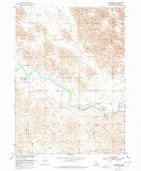
1952 Map of Brewster
USGS Topo · Published 1978About this map
The North Loup River meanders through this portion of Blaine County, defining the valley landscape south of the town of Brewster. During the early 1950s, the area remained a landscape of established family holdings, featuring the Burke Ranch to the north and the Miller Ranch to the southeast. A significant local landmark, the Brewster Cem, sits just south of the main settlement, providing a critical reference point for genealogists researching Nebraska's Sandhills heritage.
Find a feature on this map
13 named features on this map. Tap any name to fly to it.
Don’t see what you’re looking for? This feature index may not catch every label — zoom into the map to look around manually.
Map Details
Editions of this 1952 Brewster Map
3 editions found
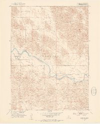
Other maps of this area

1952 · Brewster
USGS Topo · 1:24,000

1952 · Almeria NW
USGS Topo · 1:24,000

1952 · Almeria SW
USGS Topo · 1:24,000

1952 · Brewster SE
USGS Topo · 1:24,000

1952 · Brewster SW
USGS Topo · 1:24,000

1952 · Brewster NW
USGS Topo · 1:24,000

1955 · Broken Bow
USGS Topo · 1:250,000

1955 · O'Neill
USGS Topo · 1:250,000

1956 · Broken Bow
USGS Topo · 1:250,000

1959 · O'Neill
USGS Topo · 1:250,000