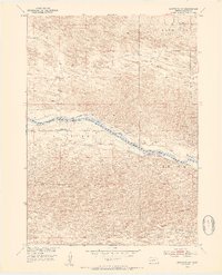
1952 Map of Brewster SW
USGS Topo · Published 1954About this map
The Middle Loup River carves a distinct path through this section of Blaine County, serving as the primary geographical focus in a landscape defined by the sandy hills and broad valleys of central Nebraska. This 1952 field-checked survey reveals the rural infrastructure of the era, including the Laughran Bridge crossing and the presence of an Abandoned Canal running parallel to the river's northern bank. These water-management features, alongside names like Edith Valley and Edith, point to the agricultural and ranching history of the Sandhills region.
Find a feature on this map
9 named features on this map. Tap any name to fly to it.
Don’t see what you’re looking for? This feature index may not catch every label — zoom into the map to look around manually.
Map Details
Editions of this 1952 Brewster SW Map
3 editions found
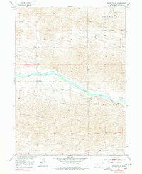
Other maps of this area

1948 · Linscott
USGS Topo · 1:62,500

1950 · Linscott
USGS Topo · 1:62,500

1951 · Dunning
USGS Topo · 1:62,500

1951 · Anselmo NE
USGS Topo · 1:24,000

1951 · Anselmo NW
USGS Topo · 1:24,000

1952 · Brewster
USGS Topo · 1:24,000

1952 · Brewster SE
USGS Topo · 1:24,000

1952 · Brewster SW
USGS Topo · 1:24,000

1952 · Brewster NW
USGS Topo · 1:24,000

1954 · North Platte
USGS Topo · 1:250,000