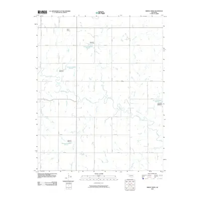
2009 Map of Bridge Creek
USGS Topo · Published 2009About this map
Bridge Creek and Skeleton Creek dominate the drainage patterns of this Logan County landscape at the start of the twenty-first century. The map reveals a strictly regulated sectional grid, where gravel and paved roads like N May Ave and E 0670 Rd define large agricultural and pastoral tracts. This rural infrastructure is punctuated by several small artificial impoundments, such as Oknoname 083055 Reservoir and its associated dam, which serve local water management needs across the prairie. For those researching family history or local landmarks, the map preserves the location of traditional burial grounds including Pleasant Ridge Cemetery in the north and Victor Cemetery further east. These sites, along with smaller tributaries like Shawnee Creek and Wolf Creek, provide essential geographic context for a region defined by its reliance on well-defined property boundaries and intermittent water sources.
Find a feature on this map
32 named features on this map. Tap any name to fly to it.
Don’t see what you’re looking for? This feature index may not catch every label — zoom into the map to look around manually.
Map Details
Editions of this 2009 Bridge Creek Map
This is the sole edition of this map. No revisions or reprints were ever made.
Other maps of this area

1892 · Guthrie
USGS Topo · 1:62,500

1892 · Kingfisher
USGS Topo · 1:125,000

1893 · Mulhall
USGS Topo · 1:62,500

1893 · Lovell
USGS Topo · 1:62,500

1895 · Kingfisher
USGS Topo · 1:125,000

1954 · Oklahoma City
USGS Topo · 1:250,000

1955 · Enid
USGS Topo · 1:250,000

1957 · Oklahoma City
USGS Topo · 1:250,000

1958 · Enid
USGS Topo · 1:250,000

1963 · Oklahoma City
USGS Topo · 1:250,000