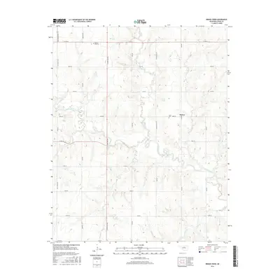
2016 Map of Bridge Creek
USGS Topo · Published 2016About this map
Skeleton Creek and its many tributaries, including Bridge Creek and Otter Creek, define the drainage patterns of this rural Logan County landscape. The settlement of Midway serves as a local point of reference, situated near the intersection of e0650 RD and N 3070 RD. The map reveals a strictly regulated grid of section-line roads, such as Mac Arthur Blvd and Pennsylvania Ave, which facilitate movement between scattered homesteads and agricultural plots. Genealogists will find the Pleasant Ridge Cem in the north and the Victor Cem near Midway, both essential markers of the area's early families. The winding course of Rock Cr and Spring Cr illustrates the persistent natural hydrology that exists beneath the modern transit network of county roads like Co Rd 62 and Co Rd 70.
Find a feature on this map
32 named features on this map. Tap any name to fly to it.
Don’t see what you’re looking for? This feature index may not catch every label — zoom into the map to look around manually.
Map Details
Editions of this 2016 Bridge Creek Map
This is the sole edition of this map. No revisions or reprints were ever made.
Other maps of this area

1892 · Guthrie
USGS Topo · 1:62,500

1892 · Kingfisher
USGS Topo · 1:125,000

1893 · Mulhall
USGS Topo · 1:62,500

1893 · Lovell
USGS Topo · 1:62,500

1895 · Kingfisher
USGS Topo · 1:125,000

1954 · Oklahoma City
USGS Topo · 1:250,000

1955 · Enid
USGS Topo · 1:250,000

1957 · Oklahoma City
USGS Topo · 1:250,000

1958 · Enid
USGS Topo · 1:250,000

1963 · Oklahoma City
USGS Topo · 1:250,000