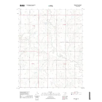
2018 Map of Bridge Creek
USGS Topo · Published 2018About this map
Midway occupies a central position in this Logan County landscape, situated where the rolling plains are deeply dissected by the extensive drainage network of Skeleton Creek. The map reveals a rural community defined by its water resources, including several numbered reservoirs such as 083055 Reservoir and 083039 Reservoir which support the local agriculture. The terrain is crisscrossed by an orderly grid of county roads, including Macarthur Blvd and Co RD 62, providing access to isolated homesteads and local landmarks. For those tracing family histories in the area, Pleasant Ridge Cem in the north and Victor Cem near Midway serve as significant genealogical anchors. Numerous tributaries, including Otter Creek, Bridge Creek, and Spring Creek, carve through the land, illustrating the complex hydrography that has shaped the settlement patterns and land use in this part of Oklahoma.
Find a feature on this map
30 named features on this map. Tap any name to fly to it.
Don’t see what you’re looking for? This feature index may not catch every label — zoom into the map to look around manually.
Map Details
Editions of this 2018 Bridge Creek Map
This is the sole edition of this map. No revisions or reprints were ever made.
Other maps of this area

1892 · Guthrie
USGS Topo · 1:62,500

1892 · Kingfisher
USGS Topo · 1:125,000

1893 · Mulhall
USGS Topo · 1:62,500

1893 · Lovell
USGS Topo · 1:62,500

1895 · Kingfisher
USGS Topo · 1:125,000

1954 · Oklahoma City
USGS Topo · 1:250,000

1955 · Enid
USGS Topo · 1:250,000

1957 · Oklahoma City
USGS Topo · 1:250,000

1958 · Enid
USGS Topo · 1:250,000

1963 · Oklahoma City
USGS Topo · 1:250,000