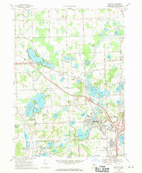
1968 Map of Brighton
USGS Topo · Published 1970About this map
Glacial lake basins and recreational development dominate the landscape of Brighton and its neighboring townships in the late 1960s. The city of Brighton serves as a hub, positioned where the Chesapeake and Ohio railroad meets major road corridors. The surrounding terrain is characterized by a high density of water bodies, from the sprawling Woodland Lake and Lake Chemung to the protected wildlands of the Brighton State Recreation Area in the southwest.
Find a feature on this map
75 named features on this map. Tap any name to fly to it.
Don’t see what you’re looking for? This feature index may not catch every label — zoom into the map to look around manually.
Map Details
Editions of this 1968 Brighton Map
3 editions found
Other maps of this area

1902 · South Lyon
USGS Topo · 1:62,500

1902 · Dexter
USGS Topo · 1:62,500

1904 · Ann Arbor
USGS Topo · 1:125,000

1906 · Dexter
USGS Topo · 1:62,500

1906 · South Lyon
USGS Topo · 1:62,500

1907 · Howell
USGS Topo · 1:62,500

1908 · Ann Arbor
USGS Topo · 1:125,000

1909 · Howell
USGS Topo · 1:62,500

1909 · Milford
USGS Topo · 1:62,500

1954 · Detroit
USGS Topo · 1:250,000
Featured Places
- Hamburg Township, MI
- Genoa Charter Township, MI
- Green Oak Charter Township, MI
- Brighton Charter Township, MI
- Hartland Township, MI