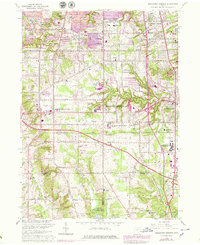
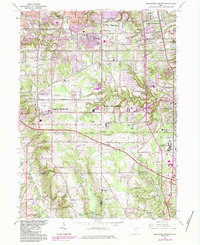
1963 Map of Broadview Heights
USGS Topo · Published 1979About this map
Broadview Heights and North Royalton anchor this topographical survey of the southern suburbs of Cleveland as they expanded in the mid-20th century. The map highlights the significant infrastructure of the era, from the sprawl of the Ohio Turnpike cutting across the center to the sprawling grounds of the Veterans Administration Hospital. Educational and religious centers like St Albert The Great Sch and St Basil Ch appear alongside numerous neighborhood schools like Nottingham Sch and Wallings Sch, reflecting rapid post-war community growth. To the south, the landscape transitions toward the Cleveland Ordnance Plant (US Military Res) and the rugged valley of the East Branch Rocky River. Deep ravines and creek beds, including Chippewa Creek and Healey Creek, demonstrate how the glacial terrain of the Connecticut Western Reserve dictated the layout of residential developments and conservation areas like the Brecksville Reservation.
Find a feature on this map
39 named features on this map. Tap any name to fly to it.
Don’t see what you’re looking for? This feature index may not catch every label — zoom into the map to look around manually.
Map Details
Editions of this 1963 Broadview Heights Map
5 editions found
Other maps of this area

1902 · Berea
USGS Topo · 1:62,500

1903 · Cleveland
USGS Topo · 1:62,500

1903 · Akron
USGS Topo · 1:62,500

1904 · Berea
USGS Topo · 1:62,500

1904 · Medina
USGS Topo · 1:62,500

1905 · Akron
USGS Topo · 1:62,500

1906 · Medina
USGS Topo · 1:62,500

1950 · Cleveland
USGS Topo · 1:250,000

1953 · Shaker Heights
USGS Topo · 1:24,000

1953 · Broadview Heights
USGS Topo · 1:24,000