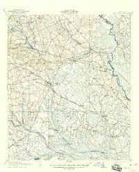
1921 Map of Brooklet
USGS Topo · Published 1921About this map
The Ogeechee River defines the eastern boundary of Bulloch County in this early twentieth-century topographic study, a landscape of low-lying wetlands and scattered agricultural settlements. The town of Brooklet serves as a central hub, situated at the junction of the Savannah and Statesboro and Midland Railway lines. These railroads provided vital connections for the region's timber and cotton economies during the post-Reconstruction era.
Find a feature on this map
49 named features on this map. Tap any name to fly to it.
Don’t see what you’re looking for? This feature index may not catch every label — zoom into the map to look around manually.
Map Details
Editions of this 1921 Brooklet Map
2 editions found
Other maps of this area

1918 · Oliver
USGS Topo · 1:62,500

1919 · Shirley
USGS Topo · 1:62,500

1919 · Claxton
USGS Topo · 1:62,500

1919 · Egypt
USGS Topo · 1:62,500

1920 · Pembroke
USGS Topo · 1:62,500

1920 · Statesboro
USGS Topo · 1:62,500

1920 · Meldrim
USGS Topo · 1:62,500

1920 · Oliver
USGS Topo · 1:62,500

1921 · Brooklet
USGS Topo · 1:62,500

1921 · Rocky Ford
USGS Topo · 1:62,500