
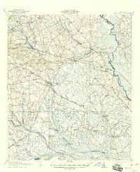
1921 Map of Brooklet
USGS Topo · Published 1921About this map
Brooklet serves as a central junction in Bulloch County, where the Midland Railway and Shearwood Railway intersect. This 1920s landscape is defined by its extensive network of rural schools and churches, reflecting a period of established agricultural communities before the consolidation of local districts. Educational landmarks like Slabville School, Hendrix School, and Pauline School are scattered across the terrain, while spiritual life is anchored by New Fellowship Church and Corinth Church.
Find a feature on this map
48 named features on this map. Tap any name to fly to it.
Don’t see what you’re looking for? This feature index may not catch every label — zoom into the map to look around manually.
Map Details
Editions of this 1921 Brooklet Map
2 editions found
Other maps of this area

1918 · Oliver
USGS Topo · 1:62,500

1919 · Shirley
USGS Topo · 1:62,500

1919 · Claxton
USGS Topo · 1:62,500

1919 · Egypt
USGS Topo · 1:62,500

1920 · Pembroke
USGS Topo · 1:62,500

1920 · Statesboro
USGS Topo · 1:62,500

1920 · Meldrim
USGS Topo · 1:62,500

1920 · Oliver
USGS Topo · 1:62,500

1921 · Rocky Ford
USGS Topo · 1:62,500

1939 · Egypt
USGS Topo · 1:62,500